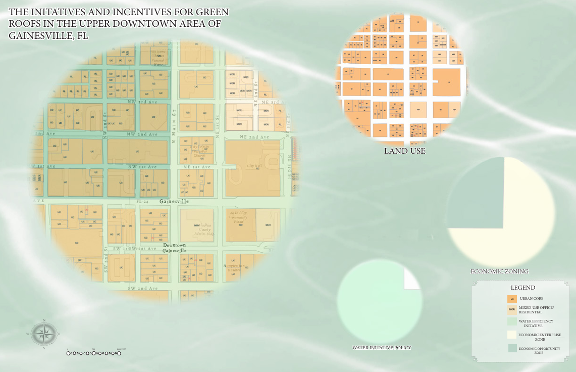
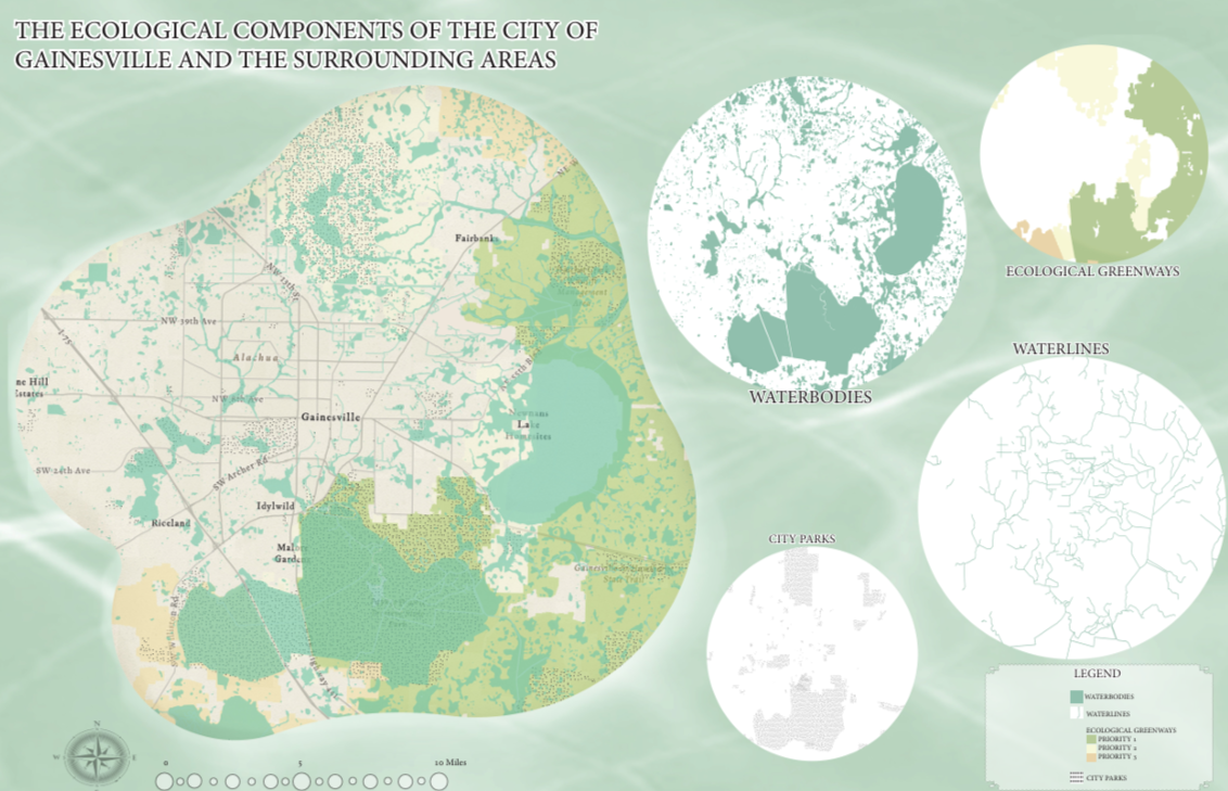
Mapping Analysis of Ecology and Policy
Through the use of ArcGIS and Adobe Suite, I utilized multi-scalar maps to analyze the ecological influences of Gainesville and the environmental initiative policies within the upper Downtown area within the city.